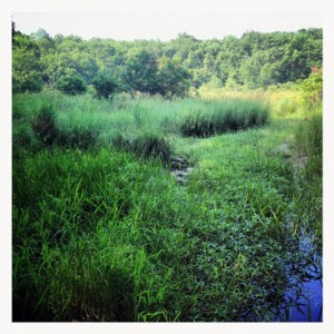
A swamp — site of a plane crash in Harriman State Park in 1974 — near St. John’s Church. ©www.myharriman.com
A plane crash in San Francisco this week was similar to a plane crash in Harriman State Park forest forty years ago. I couldn’t find much information about Northwest Airlines Flight 6231 online, until I found the AAR75-13. Then I decided to go find the plane for myself.
Flight 6231
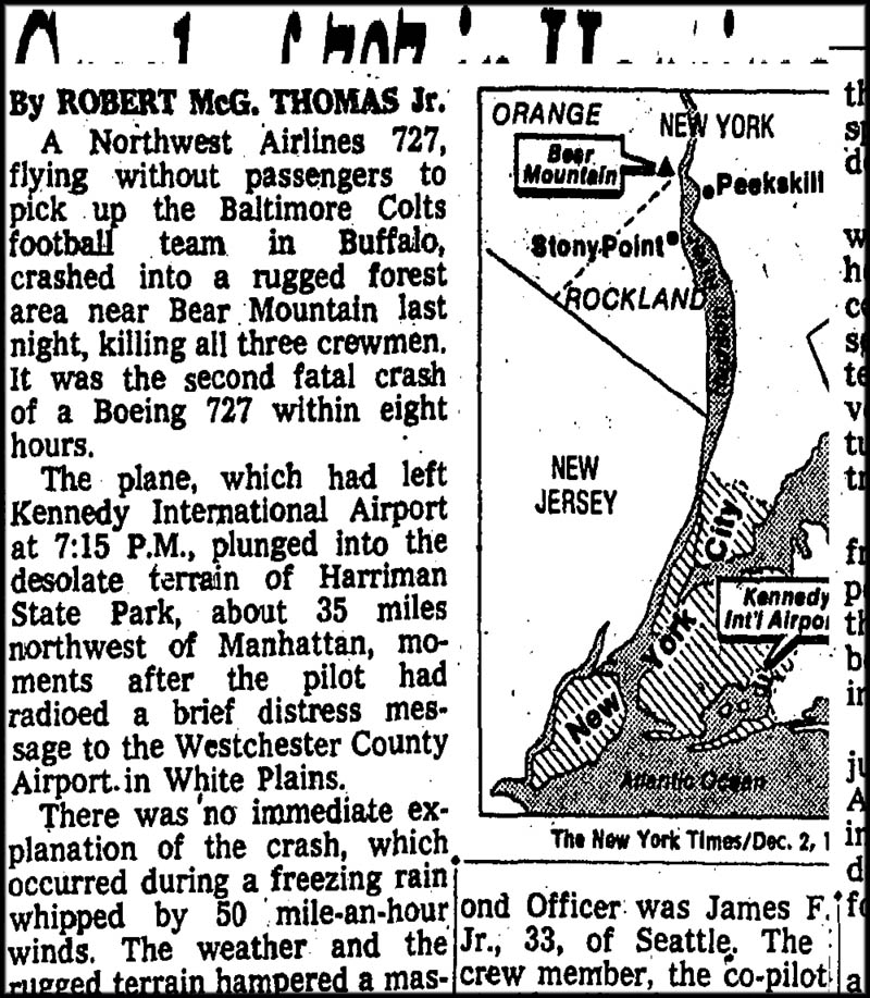
It was a large plane, a Boeing 727, that left New York’s JFK one an icy night in the 1974 winter. It carried three crew, including the pilot.
They were en route to Buffalo, New York, a chartered flight sent to pick up the NFL’s Baltimore Colts. Four minutes after take-off, at 7:24 pm, the pilot issued a Mayday and the plane disappeared from all New York radars.
I found the old AAR75-13 accident report from the NTSB online, and from it found the exact coordinates of the crash: 41 degrees 12′, 53″ N Lat, 74 degrees 5′ 40″ W Long.
These co ordinates are wrong.
Yesterday, I found it by looking at a historic aerial photo from 1975, and then going to the place. I biked in on the Turnpike, then walked to coordinates N 41° 12.903 W 074° 05.335
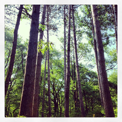
The plane’s remains are located in a sunny, ferny glen between the Long Path and the Old Turnpike, south of Lake Welch.
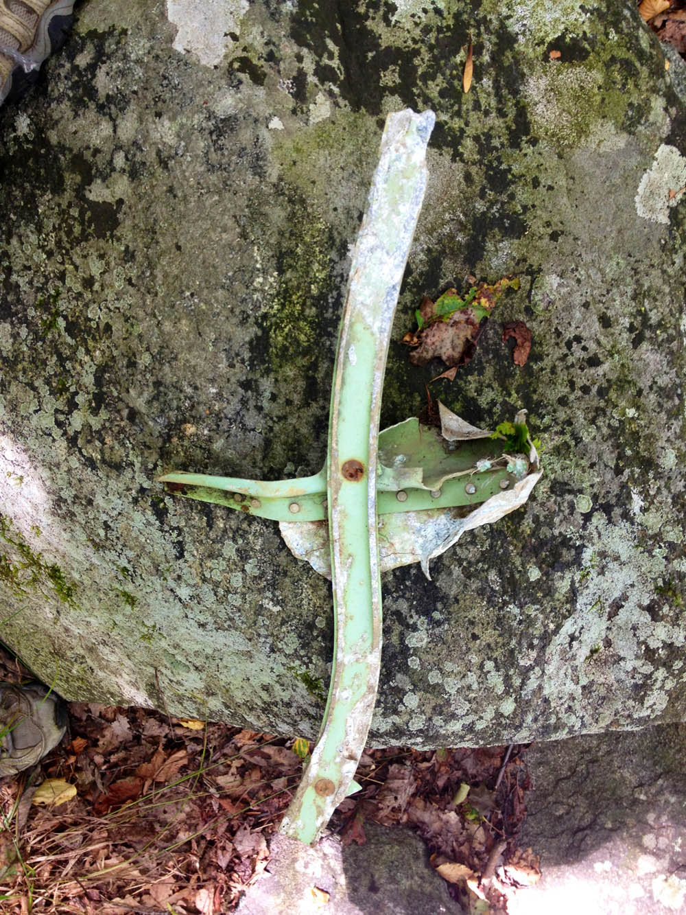
You can see lots of debris there. It’s scattered under the ferns, lots of it. Dusky aqua-green metal, old rivets, twisted stuff that’s unidentifiable to those of us who don’t know much about airplanes.
I found a piece, picked it up, and decided I didn’t want to be there anymore, and headed back up to the Old Turnpike. The piece of the airplane I found first was shaped like a little cross. Walking up to the path, I thought, it’s a shame there isn’t a memorial there, in the woods. I left the cross at the edge of the trail, propped up on a rock.


I had visited this site a few years ago, but only knew about it from a geocache listing. I found the cache which contained a NY Times article about the mishap. Strange though, I live perhaps 2.5 miles from the site (by the way the crow flys), and don’t remember the incident.
Really? Did you find anything? We were almost on top of the spot but it became much too swampy, eventually. I’ll have to look up that article. I didn’t know there was a cache there! But, it figures! I’ll post something about the cache. Thanks, John!
*I was six years old, sitting in my parent’s kitchen in Tuxedo Park on that snowy evening when the 727 crashed. I remember vividly the double-percussion boom that shook the house. I asked my Dad if that was thunder, and he replied: “No, that was something really bad..” My Dad was a 707 pilot for Pan Am, and he jumped into his Renault 10 to find out what happened. He drove towards Sloatsburg from Tuxedo and Seven-Lakes drive was blocked off by local firemen. It’s amazing how things impact a child, especially sounds. The boom shook the house/windows, similar to the sound of a close lightning strike. Very deep, double-percussion, with a rumbling echo through the mountains.
Hey Scott. Yours is a terrifying description. I’ve stood in those woods a few times and tried to imagine what it would have sounded like, a quiet woods at night, and then the plane. I didn’t imagine a child hearing it all the way to Tuxedo Park, though. Thanks for posting.
Hi Suzy,
The crash of the 727 is a vivid memory for me. I tried to describe the sound I heard in common terms. The way my parent’s house shook, and the echo that carried through the snowfall was substantial. If you’ve ever heard dynamite blasting in a neighboring town, that would be close to what I heard. Very deep rumbling impact noise. Tuxedo Park is within seven miles straight-line to the crash site. From what I read, there was no explosion or flames. The crash impact made the noise. For years, I wanted to find the crash site and go there for the mental connection to the sounds I heard as a child when the plane crashed. I searched for the site 10 years ago with some GPS coordinates obtained from a hiking website. They were incorrect. I will go to the site when the snow melts this spring. Thanks for the updated coordinates.
can you send me the coordinates for the crash site?
i am very familiar with this location …all your articles information is corect , except for the location….you walk pass the foot bridge which is on you right side pass the pines , continue on the long path for about another 200 yards and you will see a clearing right on the trail…thats the spot …there is still lots of debris there , mostly small stuff…i found a plastic peanut wrapper with northwest orient airline writen on it ..also found large peice of plexi glass window…you will be shocked on how much you can fine with a little digging (3-6 inched)…theres even bigger stuff that was to burried for me to get up…..most peices are aqua and red , the color of the plane …go and check it out you wont be disipointed…trust me…..i did lots of reasearch on this and thought it was in the swamp too at the beginning….bring a shovel and a bag…….vinny
I heard that sucker explode and I lived and still do live in Brooklyn, NY 47 miles away. It was a Sunday evening. I had just finished my obligatory Sunday dinner. It was the eve of my 17th birthday. I was cold, wet and overcast with precipitation. Boy Scouts assisted in the search. Then, ALL were recalled and sent home due to the dark and dangerous conditions. The next morning, I heard in school that the aircraft was located.
I remember driving to this sight with my father he was a cop in bear mountain at the time and worked security. I could not believe my eyes seeing huge airplane wheels in the middle of the woods along with the rest of the plane in pieces. From what I remember they reassembled the plane in the Lake Welch parking lot.
My father was James Fredrick Cox, Jr. and he was one of the pilots on Northwest Airlines flight 6231 . I was only a year and a half old when he died at Harriman State Park. Thank you for writing about the plane crash and posting pictures of the site.
I was the Lead flight attendant on this aircraft as we were diverted to ny from Washington due to the twa crash earlier that day. I think of these three wonderful guys every year and decided to research online today. Some things you forget over the years and I always regretted not contacting the families. It is still painful to talk about, but I would love to speak with anyone in the family who would like to.
I am from stony point,but in fl at the time of the crash. My Uncle was on the fire rescue, and came to visit and had some site pictures of trees and said he will never forget the smell of the jet fuel even befor thay got to the crash. So sad. That area is where our old homestead was up till thay put in Lake Welch. Tim Jones
The plane did NOT go down in the swamp, it went down a little bit further south on the Long Path. The trail runs right through the middle of the site and there are many, many pieces of the aircraft left scattered around. I have heard before of people looking in that swamp… the plane is not there. Cool place. On the northwest corner of the crash site the state police at the time constructed a small campfire from stones which is still there. Near the campfire ring there is a rather large pile of collected plane parts. The aircraft spun as it descended and the tail (containing all 3 engines) fell approx. 500ft away from the main crash site… go there, neat place, but always remember as you poke around… three men lost their lives at that spot.
Hey Pete: This was the first blog post I wrote about the site, and I followed it up with the correct location. I think I might take this post (the first) down permanently. Thanks for the information here — it’s great. As is your last sentence.
I grew up and lived at the corner of Route 210 and Blanchard Road just below lake welch
I was in mount Ivy at the time the plane hit and we heard The big thump.
Me and some friends walked up The next morning from Lake Welch dam and walked right through the wreckage .you could smell jet fuel from quite a distance away. It had dug a huge hole it must’ve come in a 45° angle almost straight down. It looks like it exploded on impact. something I will never forget.
I was on the site the next morning there’s power lines near the site and the pole near the site was #747 if you go to look find the pole it all a round
We can’t find it…we found an area that was roped off,by an orange rope…we looked for 2 hours,we are good hikers…how far is it from St Johns Church
.82 miles
My mother was on that same airplane as it arrived in NYC, just prior to that crash. But for Grace of God, she was not on the flight after it left NYC.
Please contact me regarding the construction of the Memorial for crash site. I have been contacted by the wife of the pilot, she wants to donate funds.
I am the oldest sister of John Lagorio, the pilot of this plane. I would like to be on your email list and stay informed as to the latest happenings in your wonderful memorial project for my brother.
Gordon Wren and I have been in touch and are working together toward building a memorial on the crash site. We have both been in touch with some of the families. It now appears we have enough funds to complete the memorial (estimates of about $1,000). Gordon has arrange with the Parks Commission a walk through of the crash site so that the Parks Commission can approve the exact location of the memorial. We are planning to accomplish this on Saturday, June 27th. Once this is complete we will work with the various families on the approved wording. One this is complete and the finances have been approved, Gordon and I will work on the actual dedication date and construction. All media must be approved but the families, so at this point we are not seeking media attention. If you have any questions, please contact Gordon or me at gary@reachoutcom.com I will provide you my phone number also.
I’m John Lagorio’s sister, and this has been a most extraordinary day in my life, finding out about your concerns for my brother’s accident 40 years ago. His wife Cathy and I have been on the phone a great deal since then as you can imagine. John was a loving and much loved person all his life, and I’m sure all of us can share as many interesting stories of his life as you’d care to hear. I give you my email address so I can be kept informed about what is happening with your memorial. I would be happy to donate to it as well.
I’m the daughter of James Cox, one of the pilots,and would like to be the point of contact for our family since our mother June has since passed away. Thank you!
I’d like to to be notified when the dedication is scheduled. Went out to try and find this sight today but couldn’t. Will try again. Glad to know something is being done and that relatives are involved.
There is now an historical marker. I have a photo. But your comment box will not allow me to post it.
We could not find the site…is it near the church?
I was at the site a few years after the crash, in the late 70’s. I was staying at a nearby youth camp, and the counselors were very familiar with the crash site. I was probably 10-11 years old at the time. Back then, you didn’t need to dig to find plane parts. There were many scattered on the ground. I never forgot the feeling. Even at that age, I had some appreciation for what happened there. Today, I decided to Google it because I will be staying there again soon. The youth camp was named “Lanowa”, whose entrance is very close, on Camp Winaki road. I was told it was also called “Camp Wakanda” many more years ago. Today, it is an AMC campground where you can stay the night in a cabin, lean-to or tent. I am planning to stay there in June. I think I will try to visit the site again. I see that there are family members who have posted here. I will try to take pictures and document as much as I can.
AMC Camp: http://www.outdoors.org/lodging-camping/Lodges/harriman/
Google Map Link to Crash Site: https://goo.gl/maps/gsASnSAEZHQ2
Google Map Link to Camp Site: https://goo.gl/maps/E83C3jpkygu
I visited the site in mid- February. I parked on the side of the road and walked the road for the camp site and then made a left about a mile up to get to the marker. The coordinates Suzy listed in the comments are spot on correct. I couldn´t dig much due to the snow on the ground but I did find some larger pieces of medal in the ground still near the site. I also found a piece of it looked like a seatbelt buckler or a piece of a luggage strap. I would like to visit the site again in the spring to see what else I could find. It is amazing how close the site is to the long path. I also found interesting that so many planes courses flew right over the site as I was at it, it must be a course that planes fly.
I was there today. There is now a monument from palisade park commission. Most wreckage neatly piled by marker. It is now on the long path
My grandfather, Joseph Trainor, was an officer with the Palisades Park Police when the crash happened. He passed away on 6/11/19 and we found a photo of the site as well as a letter that he received from Northwest Airlines thanking him for assembling a crew of men to secure the scene. If anyone is interested in seeing these items, please email me atjschultz1111@gmail.com.
My grandfather, Joseph Trainor, was an officer with the Palisades Park Police when the crash happened. He passed away on 6/11/19 and we found a photo of the site as well as a letter that he received from Northwest Airlines thanking him for assembling a crew of men to secure the scene. If anyone is interested in seeing these items, please email me at jschultz1111@gmail.com.
I didn’t hear about this crash until a few hours after it happened. Why? Because I was also on a flight from New York to Buffalo at the exact same time. But my flight was from LaGuardia on American. My mother had been laying in bed listening to the radio news when they reported the crash of a New York to Buffalo flight. She told me afterward that she levitated off the bed from fright. I’ve lived in Orange Country, on the western side of Harriman State Park, and I’ve often wondered where the exact crash site is. This article provides a bit of closure. You probably know that another 727, TWA crashed near Washington DC on the very same day.