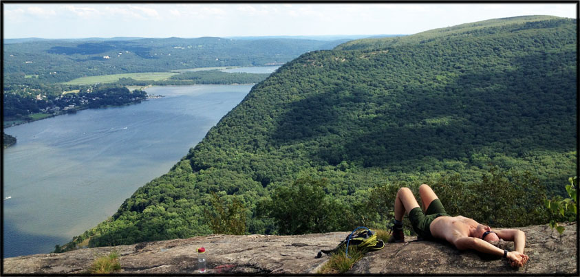
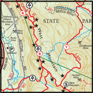
Find the best hikes in Harriman State Park by following the stars — the viewpoints — on the hiking trail maps. This is the beautiful Timp-Torne trail on West Mountain, where it merges with the Appalachian Trail.
There’s a simple way to find the best hikes in Harriman State Park: follow the stars.
Some may disagree, but I find the best way to find a great hike in Harriman State Park is to forgo the trail descriptions found on the internet, and discover them yourself by using the Trail Conference Maps, and looking for the stars.
You’ll find little black stars spread out all over the map, and these indicate the best viewpoints in the park, along well-marked trails.
Some trails, like the Seven Hills Trail on the Harriman South map and the Appalachian Trail/Timp-Torne trail on West Mountain, are littered with stars! Star-heavy trails tend to be my favorite hikes.
There are other symbols on the maps that make them a joy to read, even when you’re far from the trail, just sitting at home as the snow falls outside.

The best hiking trails are littered with stars. This one — on the Howell trail, Storm King Mountain, not far from Harriman — is a viewpoint over the Hudson River that’s earned a big fat juicy star on the West Hudson mapset (Map 113, NY-NJ Trail Conference)
(You will also need the maps, in the planning stage of your hike, to determine where to park. Parking spots are marked on the map with a “P”; permitted road-side parking with a faded “P”.)
As a resource (in addition to the Trail Conference’s website), subscribe to the wonderful local hiking blog, “Gone Hikin’, here: http://gonehikin.blogspot.com/


Harriman is so close to New York City, and New Yorkers are so obnoxious (and I live in NYC) — polluting, blaring radios, whining about not getting a cell phone signal, dumping crap everywhere, not respecting other hikers or campers — that I will _never_ share my best hiking routes, even with friends. A website publishes a route, and all of a sudden, there are a hundred people on the trail in one afternoon, or worse. Out west, I know rangers and hikers who avoid mentioning whole wilderness areas. I don’t know what it is about being a city resident — especially east coast or LA — that makes people think they can treat the wilderness like the New York City subway.
I totally agree, just look at Breakneck Ridge. But there are also some good city slickers too. I’m from NYC and I follow LNT rules on the trail and in the city.