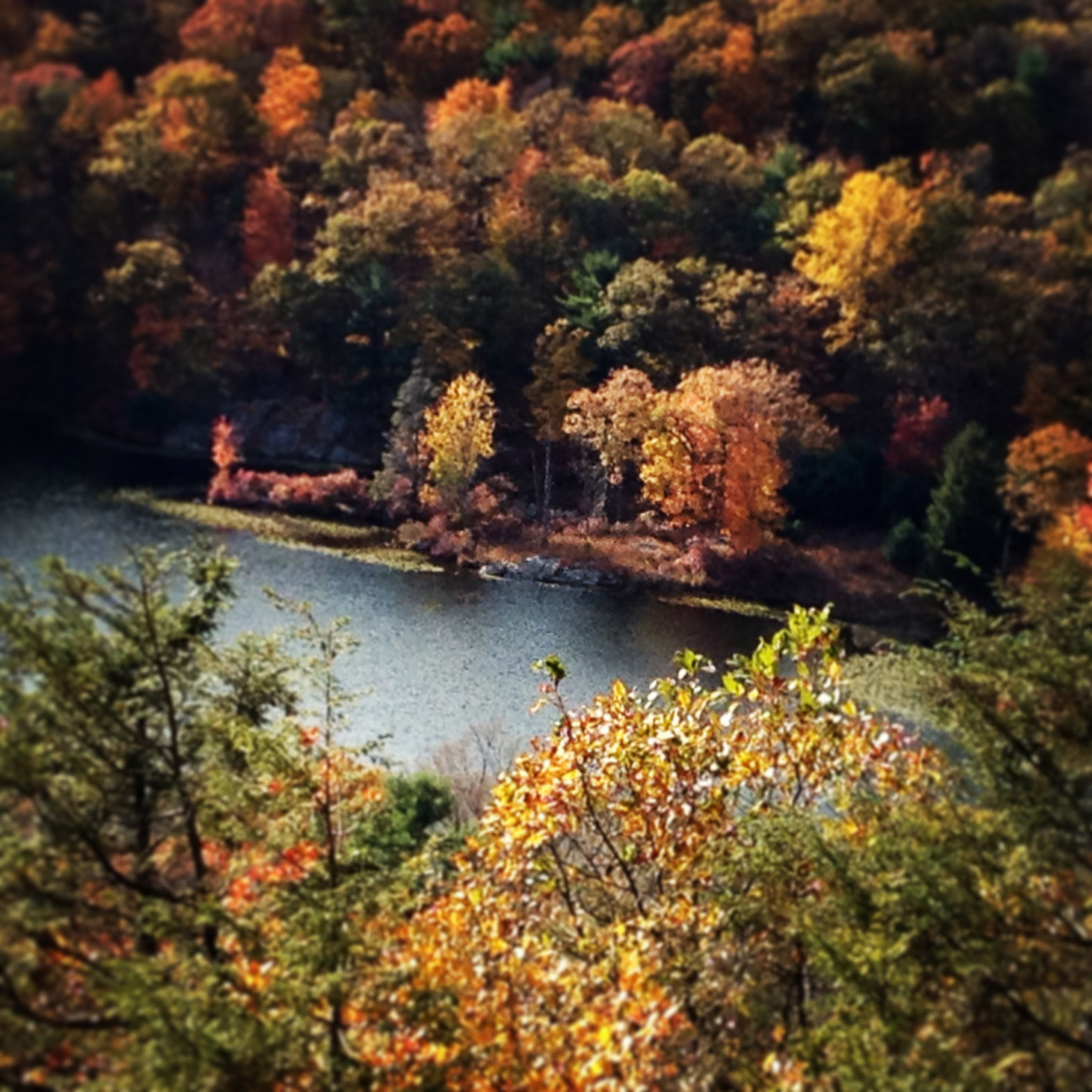
The view from Stahahe High Peak, off Island Pond Road, in Harriman State Park. A hike of a little over a half hour will get you to this viewpoint.
Sometimes you are working on a problem, or you’re hung up on a project at work, and although it’s stuck in your head, you’re not bearing down on it.
That’s when I hike.
An unmarked trail off Harriman State Park’s Island Pond Road — a woods road through western side of the park just north of Tuxedo — leads only slightly uphill, through a hemlock wood, and to the open vistas on a rocky hilltop overlooking Lake Stahahe.
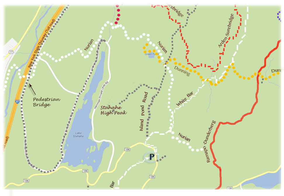
Download the Trail Map PDF for Stahahe High Peak Trail.

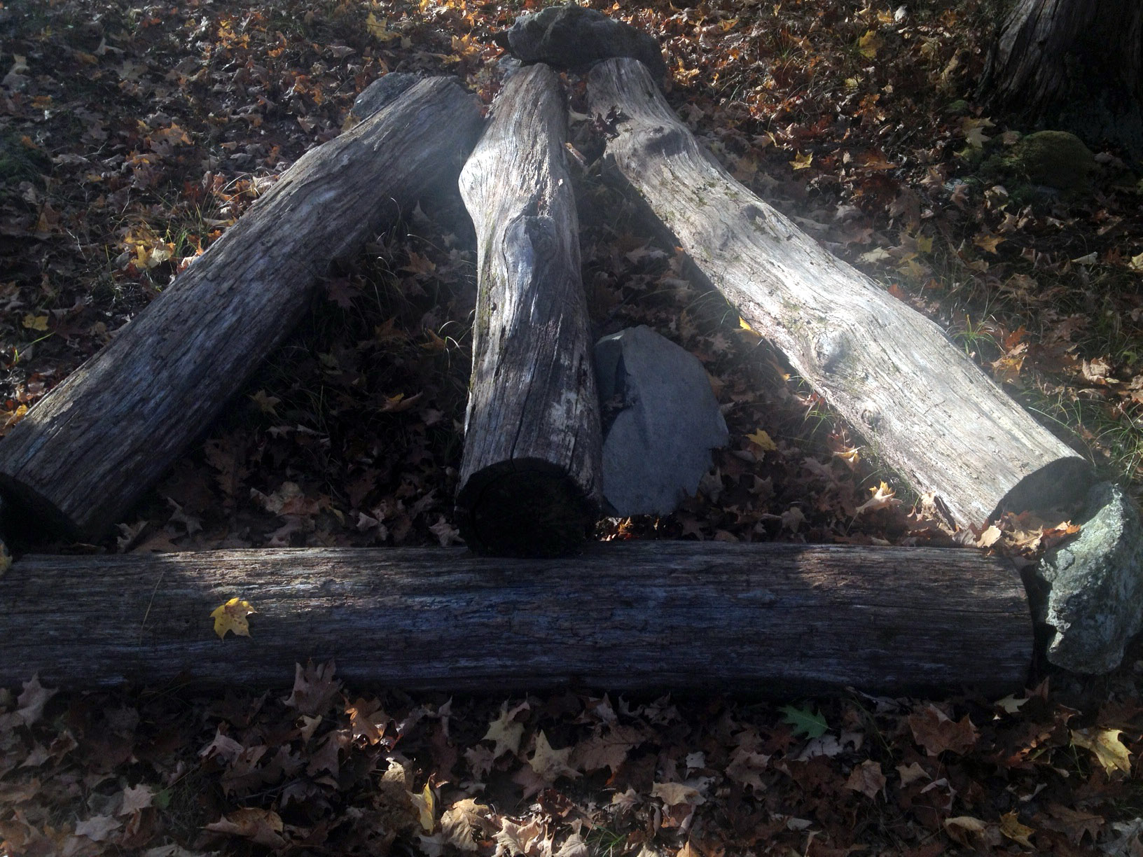
Four logs form an arrow at the intersection of an unmarked trail to Stahahe High Peak, and Island Pond Road, a woods road in western Harriman State Park.
To reach the trail, park in the pull-out on 106 (GPS: 41.23473, -74.14914) and take the White Bar trail on the other side of the road as it parallels the road, then turns to the right. Almost immediately, the trail forks; go left onto the woods road, and follow it for another half mile until another unmarked trails appears to the left, faint in the colorful fallen leaves, marked on the ground by four logs placed in the shape of an arrow.
Some “stealth” blue blazes mark the way through a laurel, then hemlock wood, and then uphill to a rocky bald where the grasses start to show, and soon you’re at the most beautiful overlook. Lake Stahahe glistens below.
It really is worth every step, you can reach it in less than a half hour, and it’s a great excuse to get away from the desk and still be working on something.

A short hike from the parking lot on Route 106 brings you to a rocky overlook, above Lake Stahahe, in Harriman State Park.


I have been a Harriman park lover since I arrived in Rockland County in 1966. Has anyone else noticed that all the roadways in the park were regraded and repaved and that ALL the roadside cutouts were eliminated?
Suddenly access to so much of the park has vanished!
Hi Joseph: Thanks for the comment. I hadn’t noticed that, but I’d like to check it out and find out why.
thanks. yea, if you notice the road was not only paved, but deliberately regraded, the entire length of seven lakes and I believe 106 were graded with deep ditches on either side.
Strange isn’t it that the very purpose of the park, to be there for it’s people, would end up being restricted in this way? Another example of safety issues over freedom of exploration?
Joe, I see what you mean, though I wonder if it isn’t just to keep the water from pooling up on the roads. But I think that the state does almost deliberately try to keep numbers down at the park, except for in the beach areas. There’s almost no benefit to them to make it easier for people to use the park.
The state website for Harriman is ridiculous. If you need to know how to get there, and you use their “getting there” page, you’d end up on the off-ramp for Lake Welch parkway (which is closed in winter anyway). Under “Park Hours”, it tells you to call the park. Need a map? Get the firewood map. Under “Resources and Links”, they don’t even list the Trail Conference.
Thanks for the comments, Joe.
thanks. let me know what you find out.
We did this hike three weeks ago. And have a photo overlooking Lake Stahae almost exactly like yours. It is a great short hike indeed, though the “stealth” blue trail does get a little hard to follow towards the end. Keep to the high ground, and you won’t go far wrong.
It would probably be easier to follow if we could get a leaf-blower in there!
By the way, readers can click on William’s name (above) for a link to his route, with elevation information and distance for this hike.
Thanks, William!
is this the lake where the German Ski Club had a campsite? I learned how to swim there, played badminton, gathered blueberries and more. This would have been in the early ’40s.
Yes! Stahahe had the German Ski Club. Thanks for commenting, Constance!
We hiked Arden Surebridge to Island Pond Road to the Stahahe High Peak today. Amazing. Easy to find the unmarked trail off Island Pond but not so easy once we went down to the other side of the peak and walked north past the lake and campgrounds. Kept looking for the ‘woods road’ on our Harriman Park Trail Map (a 2001 map!). It was to run along side the Stahahe Brook and lead around Green Pond Mountain back to Arden Road. We followed uphill of the brook and eventually found somewhat of a woods road, but was not easy! Very thankful to the NYNJTC volunteers who clear trails. I don’t know what we’d do without them:)
IN JULY OF 1950 A SMALL PLANE CRASED INTO HIGH PEAK, REPORTED IT TO CSS COUNSELORS, BUT THEY DID NOT BELIEVE ME, REJECTED AND WALKING AWAY ENCOUNTERED A CAMPER OUT OF BREATH, ASKED JHIM IF HE WAS FROM THE CRASH, SAID HE WAS NEARBY AnD WENT FOR HELP, LED TU OFFICE AND THEN THEY BELIEVED ME, UNFORTUNATELY A FATHER AND 14 YEAR OLD DAUGHTER DIED IN ATHE CRASH, THE PLANE WAS DOING LOOP TO LOOPS STALLED AND WENT INTO TAILSPIN AND CRASHED IN SPITE OF THAT STAHAHE WAS A BEAUTIFUL LAKE AND FULL OF LIFE, ACID RAIN SEVERELY DAMAGED STAHAHE, IT IS NOWHERE WHERE IT ONCE WAS
I learned to swim in Lake Stahahe while I was a camper at Camp H.E.S. 1971-1980.
I went to camp HES in the early to mid-70s and remember living on Lake Stahahe during summer camp. It was named after the Stahahe Indians we were told. I have visited a few times and the campsite on the hill (boys site) is now decimated, the lower bunks appear to be used by someone and also have airconditioning!?
For me, it was 1963-1970. Loved Camp H.E.S. Met one of my best friends to this day, there.
The trail is now harder to find. There is a new arrow on the right hand side of the Island Pond road just before the turnoff to the left. The blue paint is still on the trees on the way up and back.
Hiked this trail yesterday. Left The Camp Eureka area and caught the Nurian (White) Trail at the North end of Lake Stahahe. We followed that Trail to the Island Pond Road, and picked up the blue markers to the summit. Was able to follow the trail markers to the summit, caught a beautiful view, and bushwhacked in a southwesterly direction down some somewhat steep rocks (for the area) until we came to a large blue water storage tank, and thus a gravel road down and out the rest of the way. until we hit the paved roadway back to Camp Eureka.
I am somewhat surprised at the mostly abandoned camps along this road. It looks like this was once an area where camps introduced many youth to the joys of being outdoors. What happened? Why are these facilities unused and in such disrepair? Can something be done to revitalize this gem and bring back laughter and shenanigans that always come with summer camp, the wilderness, and young kids…
For me, it was 1963-1970. Loved Camp H.E.S. Met one of my best friends to this day, there.
Sorry I am so late to this conversation. I just came from lake stahahe. Actually there is no way to get to the lake. The one road to it is locked like many of the other roads in Harriman. Someone lives in one of the stone houses on this “private lake”. I can see private docks on the lake in the distance. Who owns these? In my mind this is theft of public property. 47k acres and nowhere to park, legally, except with large groups of picnickers, complete with boom boxes. What a “crime”.
YES, it is a crime that this is
being gotten away with due to politics which comes along side crookedness. one of the park workers lives there with his wife who runs the museums who were hired out of state b.c they new someone. the group camp road is rented to private organizations. but there is a parking lot and a trail( i believe Nurion)by the parks stone house which travels around lake and up to highpoint, green n island pond. They have blocked access to lake, they have deemed the lake unsafe to the public b.c. of the invasive weed that it does NOT have,HAS see weed but not the contagious, invasive weed thats gives them the right for this.blocked off the public parking and marked private, also closed it in winter for ice fishing! They have unnecessarily removed wildlife for nothing but nuisance reasons. the so called lake worker who lives on the lake and loves to pretend to be for man has done absolutley nothing to keep these camp facilities safe and rentable. in fact he has destroyed countless buildings b.c. of shear neglect. He doesnt trim the trees properly, does not clear any buildings of the dangers of trees falling on them. He Never Ever repairs anything damaged. Bribes those who are summer residents to actually do his job! They seem to have claimed the lake as their own private property!In fact “he loves to scare n yell at people that they cant be there” Yes it is still state property and they will only get away with this for so long. everyone is scared to report these un deserving, non nurturing selfish people. SHAME ON THE PARK FOR ALLOWING THEM TO GET AWAY WITH THIS!Call the group camp office. Call the Park, Report to the park Police. Ask where its printed that you cant park in a public lot. Make a complaint. People like this are destroying and taking away what is our right, what has been given to us the people to enjoy!And why BECAUSE THEY CAN GET AWAY WITH IT>so speak up please. i also want to mention they have periodically covered some of the markers on the trees with blue paint to try to keep people out.
Lake Stahahe needs nurturing and help. It is being over taken by weeds on the man made side of the lake. It needs proper taken care of or it will turn into a swamp. This is such a shame that a once resident filled summer camps on a beautiful lake is just a distant memory. Mary Harriman donated all this land for others less fortunate to enjoy. Please Speak up, Dont let this be taken away from us.
Hike to High Peak is highly rewarding and easily completed.
As an old YMCA camper from S-2 Camp NENDAWEN, who is 74 and did it on Thursday September 15, 2022.