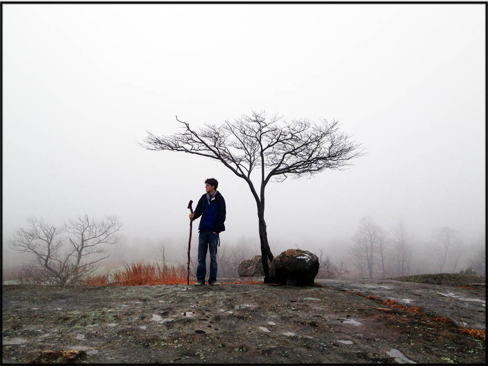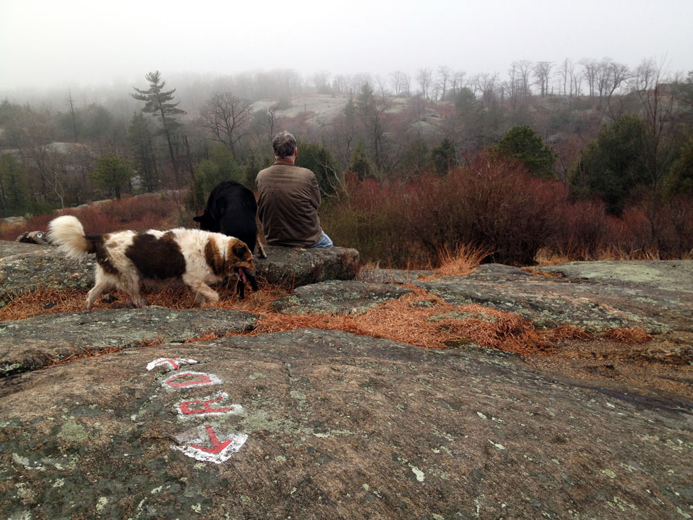
Lone tree and hiker atop Hogencamp Mountain in Harriman State Park, along the Ramapo Dunderberg Trail. To really appreciate the hidden landscapes of Harriman, go deep.
This is really one of my all-time favorite hikes in Harriman, so I’m posting a quick waypoint description.
Why’s it so great? Wild views only .5 miles in. Rocky ridgelines, interesting forest trails, and a figure-eight that means you won’t be backtracking, except at the very end. A mountaintop memorial. Bowling Rocks.
I love it. It’s everything I’ve come to love about Harriman. If I lived in New York City, this would be my wildest, best refuge, just a short hour’s drive away.

This hike follows the Ramapo Dunderberg Trail over some beautiful, remote scenic vistas and ridgelines, with scrubby hilltop vegetation, pitch pines and low-lying hemlock forest.
Getting to the trailhead GPS: 41.23043 N, 74.14005 W):
1-87 north to exit 15A (Sloatsburg/Suffern). Turn left on NY 17 for 7.2 miles, then left at sign for 17A. Turn right at the top of the ramp onto county route 106 toward Bear Mountain. Go 3.8 miles, park on the left in the pullout.
The Route (6.1 miles or so):
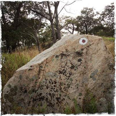
Mile 0: Ramapo-Dunderberg Trail (white blazed with red dot) heads east from parking lot before bending north.
.5 Right at T-junction on the ridgetop (and enjoy the views) to stay on the Ramapo-Dunderberg trail.
1.3 Beautiful Bald Rocks Shelter on right; good camping; water in gulley below the shelter.
1.4 Right at four-way intersection, onto Dunning trail (yellow blaze). Expansive views and wonderful ridgeline hiking and vegetation, to make you feel far, far away from New York City.
2.8 Left at 3-way juntion onto Long Path (aqua blaze); watch for old Hogencamp mines to left, before and just after the junction.
3.5 Left at 4-way intersection onto Ramapo-Dunderberg Trail (white blaze, red dot). This is “Times Square”, and you’ll have to be careful here, because it’s confusing. It’s almost a five-way intersection! But stay left on the R-D trail, heading southwest. Lovely views at miles 3.6.
4.2 Left at T-junction to stay on the Ramapo-Dunderberg Trail (white blaze, red dot). Don’t turn right onto the blue-blazed Lichen Trail. And keep an eye out for Ship Rock, just before the intersection.
4.6 Right at 4-way intersection onto Dunning Trail (yellow blazes). You’ve been here before!
4.9 Left at T-junction to join the White Bar Trail. The yellow and white trails will run together for .25 mile; then the yellow trail will leave to the right, but you’ll stay left on White Bar Trail.
6.1 Left at three-way intersection onto Nurian Trail (white blzzes); these two white-blazed trails will run together for .15 of a mile. Soon they split; take the white-blazed Nurian Trail to the left.
The next intersection is with the Ramapo-Dunderberg trail. Turn right, and return to the parking area.
The Map:

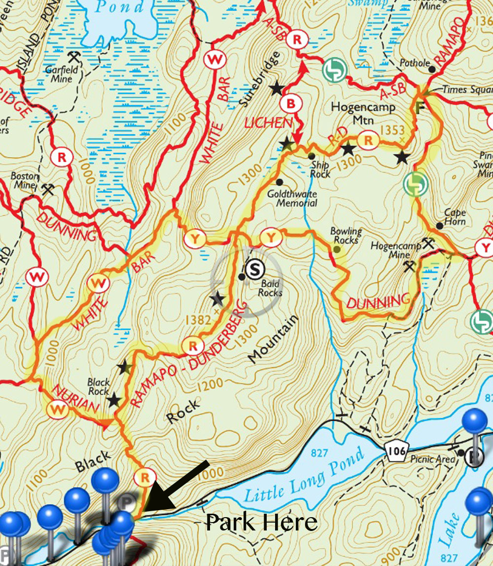
Trail map describing a figure-eight hike over Hogencamp Mountain, via the Ramapo Dunderberg Trail, the Dunning Trail and the White Bar Trail. One of the finest hikes in Harriman State Park, under 7 miles.


Thanks for the posting I did this hike today. Good directions, tho I did get a little turned around at the Nurian RD junction, my fault did not see the blazes, everything worked out though, for a minute I thought I might just bushwhack down to 106 but no need picked up RD. Nice cool day but fortunately very little ice around.
Charlie, if you tend to get turned around, you should try the Avenza app (on your iphone or android). It’s free, and from there you can download the NYNJ Trail Conference maps for the trails in Harriman (and other places). These will show you exactly where you are on the trail. I never get lost anymore.
I don’t have any relationship with the trail conference, so I’m not promoting their maps or the app for my own good. They’re just really great, and I never hike without them.
Thanks for posting!!
That is an incredibly useful app, thanks for mentioning it. Had no idea it was out there. Love this site, so many great tips.
Thank you so much. Just downloaded the app and maps!
Yes, if only I had a smart phone! I actually do have an iPad with gps capacity so if I wanted to haul that along I could. I also have a little Garmin pocket GPS unit, which probably would not accept those map files, generally the problem with the Garmin is that only the Garmin map files, which you have to pay them for at their site, will work. I don’t have the Harriman files from Garmin. At Harriman I am ok with a map and compass, if I do really lose the trail I can always get out of there or find another trail one way or another with the map/compass. Unlike some places where I am happy to pay Garmin for the map and trail files because a quick bushwhack is just NOT an option!
Love your site! First time at Harriman, did lower part of this trail today with my wife. Maps would not initialize (android not Iphone). Any ideas? Would have hiked further if the map worked.
This is a great hike and description, love the site, but this hike is over 10 miles … not 6.1 miles … might want to update that …
According to the National Geographic map, which I’ve used without fail for years, it is a 6.6 mile hike just as the description states (description doesn’t include the last 0.5 mile back to lot from the intersection).
I did a much shorter version of this hike, not doing the top half of the figure 8, and my pedometer was nearly 6 miles. I agree 6 miles for this entire hike is not accurate, more like 12.
Its a great hike, just do the bottom loop for a shorter hike. Thanks for posting.
Approximately how long would you estimate this hike takes?
My wife and I did this hike Sunday and loved it. What a great recommendation! Thanks for the post.
We only did the lower loop (i.e. took a left at the Dunning trail), and the pedometer said it was about 3.85 miles). I took some photos from the hike:
https://www.flickr.com/photos/beaufour/albums/72157660303888870
Hey just wanted to say that I was super psyched to do this trail but FYI Route 106 closes for the winter and was unable to access the trails w/o extending the trip (which I had limited time) The park website and this website did not mention the road closure-so for all winter backpackers this is your notice lol.
In winter, you can do a version of the same hike starting at the Kanawauke Picnic Area instead. Just park at the lot, walk weest on the empty 106 and take the first fire road at the green gate north. It will join the Dunning trail mid-route that Suzy described above. Complete the “8” and come back the same way.
You cannot do this in winter. New York State website says route 106 is closed all the way from Rt 17 to the Kanawauke Traffic Circle. How owuld you get to the picnic area, helicopter?
Martin, although the web site might say that, the road closes after the entrance to the Kanawauke Picnic Area. The sign at the traffic circle says road closed ahead. It allows you to get to the picnic area for parking. No helicopter is needed. So yes, you can do this in winter by walking along empty Route 106.
Hi Suzy,
We just did this hike on Saturday. The rocky ridge-line and views were fantastic. It was such an amazing experience. Although, we could not find any yellow blazes. Have you been on this hike recently? We ended up hiking very far on the RD trail, and turning around after 6 miles and back-tracking, making it a 12 mile hike. Even on our back-track, we re-read all of your directions, and there are no yellow blazes to be found! We found Times Square and the blue blazes, but no yellow blazes (or Ship Rock). I don’t know if they have become so faded that they are no longer noticeable. Any thoughts or guidance for the future is appreciated.
Great hike. It is 7 miles – not sure how some of the posters come up with more mileage. It’s easy to check on the trail conference maps which show mileage. It’s been mentioned before but the Avenza app is gold. Impossible to get lost.
Did it again today. It is so beautiful! Took me 3:20 with a few fairly brief stops. One more comment regarding the discussion about distance above: a pedometer is very inaccurate on these rocky trails. The pedometer counts your steps and assumes a certain stride length. On a trail like this with many ups and downs and rocky paths you will make many steps that are much shorter than your normal stride length. Therefore, the pedometer comes up with a significantly longer distance. Last weekend I did Breackneck Ridge. The loop is 3 miles. Two friends of mine came along with pedometers. They both showed well above 5 miles.
Great Hike!! 6.7 miles by my GPS
Can you just park overnight in the parking lots at the junction of Route 17, 17A, and Kanawauke Road? Or do you need some sort of permit? It would be during the week.