Here’s an easy overnight trip that starts along the Hudson River, ends with a beer at Bear Mountain Inn, and puts you in one of the prettiest viewsheds in the Hudson Valley.
In 2016, I’m challenging myself to spend at least one night a month sleeping out under the stars. It’s been easy so far, since the weather’s been unusually warm and comfortable.
You don’t need a car to do an overnight loop in Harriman, and enjoy magical views of New York City from your lean-to.
With the last night of February upon me suddenly, I set out to climb West Mountain from the Timp-Torne Trail. This is an easy, solitary and spectacular hike-with-lean-to. What’s more, if you live in the city, you can easily reach your starting point by bus from Port Authority, and catch it home again the following afternoon or evening.
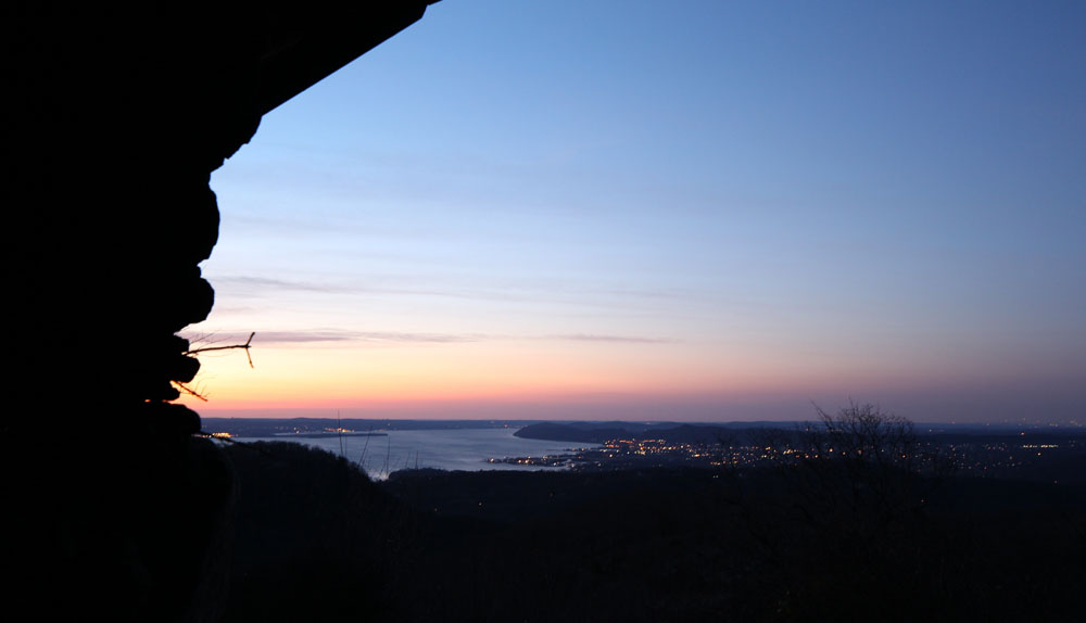
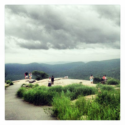
The highlight of this trip, for me, is staying overnight at the West Mountain Shelter. It’s a lean-to perched on a rocky slab overlooking the mountainside, with the Hudson River, the scattered river towns, and distant Manhattan skyline in view beyond. When the sun sets, the view is spectacular on a clear evening, the river throwing back to the darkening sky that mysterious cast of blue. You sleep, turned to the open side of the lean-to, with all this to greet you whenever you wake in the night (who sleeps soundly on the floor of a lean-to?). The sunrise is no less breathtaking, as you see both east and west from the shelter.
Don’t be convinced that Harriman is a crowded park. Sure, I was hiking on a weekday, which is always quieter than a busy weekend. But I only met one single person on my entire two-day hike, and that was near the end, coming down off Bear Mountain. Plan your trip during the week, and you’re much more likely to get a lean-to — even popular West Mountain Shelter — to yourself.
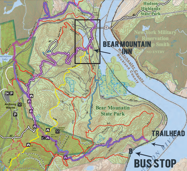
Get off the bus at the Tompkins Cove stop (lower right), and hike north to the trailhead, where blue blazes on a post mark the start of the trail. (You’ll see red blazes, too.). Then follow the blue-blazed Timp-Torne trail marked here, choosing to go all the way or turn east on the white-blazed Appalachian Trail back to the Inn.
Here’s how you can take the bus to your next weekend, and back again:
- Catch the Shortline Bus from Port Authority to the trailhead. Tell the driver to drop you off at the Tomkins Cove bus stop on Route 9W — it’s the last stop before you get to Bear Mountain. I’ve noted the bus times below. A round-trip ticket will cost you around $24.60.
- Once you hop off, walk north along Route 9W (with the river on your right) to reach the trailhead of the Timp-Torne trail. It’s less than a half-mile up the road. You’ll see a post in the brambles, blazed with blue blazes and also red blazes (the Ramapo-Dunderberg trail also starts here).
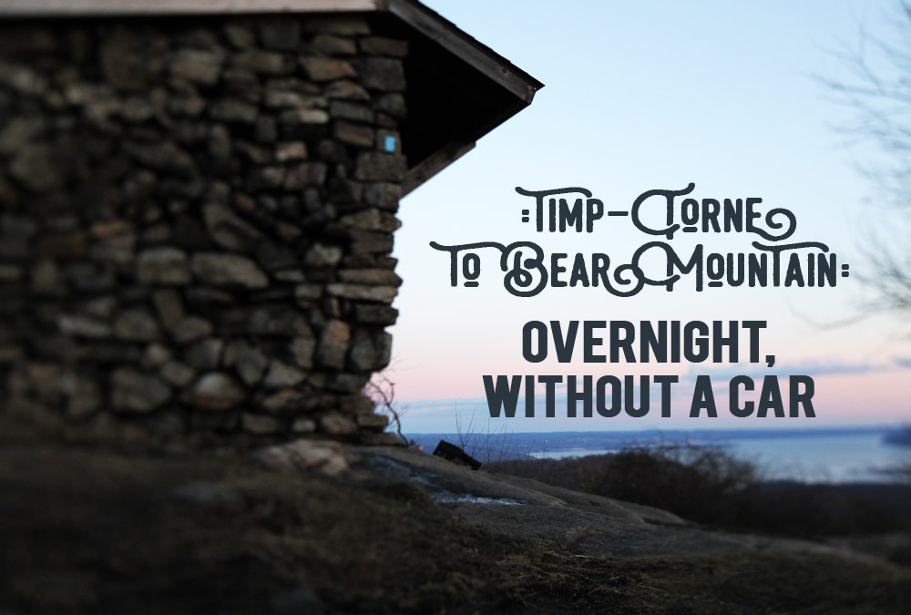
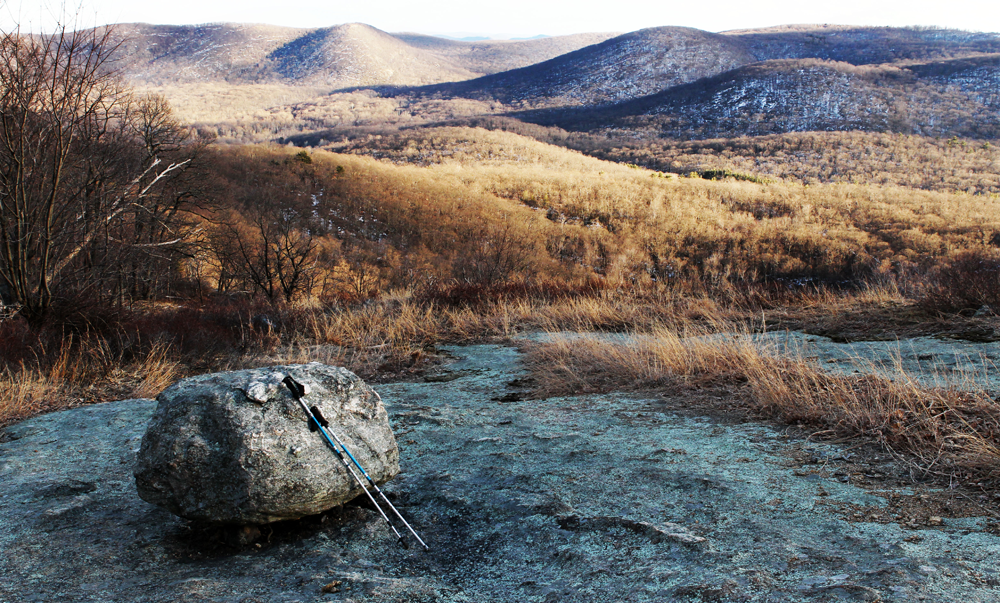
- Then, you’ll follow those blue dots all the way to West Mountain shelter, where you’ll bed down for the night. Over the top of the Timp you go, enjoying rocky, whaleback mountaintops and views down the Hudson River (finally leaving those views of Indian Point power plant behind). Don’t worry about missing the shelter; it’s right on the trail (see the blue blaze on the side of the shelter in the picture?)
- Enjoy a fire in one of the interior fireplaces at the shelter. A few fire rings surround that shelter, and you can pitch a tent or hammock within sight of the shelter if you find it already occupied. PLEASE: Leave No Trace when you leave the following day. Another please: Bring toilet paper and a “wag bag” for your used toilet paper. I have left-over dog bags from when I had shepherds and they do the trick!
- The next day, pack up and sweep out the lean-to. If you don’t have enough water to make coffee and oatmeal, put off breakfast until you can gather water from a stream (there’s one at the bottom of West Mountain). Keep following the blue-blazed Timp-Torne Trail. When you at last come to the intersection with the Appalachian Trail, you can decide: Continue on the T-T? Or follow the AT back to Bear Mountain?
- If you stay on the Timp-Torne, you’ll head up and over the top of the Popolopen Torne. This is a steep and sometimes scramble-y treck to the top. But, the scenery is special, the top of the Popolopen Torne is a breathtaking spot, and you’ll be a “completist” for finishing the whole 11 miles of blue-blazed trail! This is a longer route back to the Bear Mountain Inn. The trail itself terminates at Fort Montgomery State Historic Site, but you can walk the very short Twin Forts Trail under the bridge, returning to the Inn (and walking through the Trailside Zoo!)
- If you turn off on the Appalachian Trail, it’s a shorter hike back to Bear Mountain Inn, the top of Bear Mountain is a great place to relax and soak up the view (and in summer, get a soda from the vending machine). Plus, you’ll enjoy the artistry of the stone staircases descending into the Bear Mountain Inn park area.
- Waiting for you at the end of the trail is the Bear Mountain Inn. I love that there’s a bar and grill, fancy restaurant, gift shop and even an ice cream shop at the end of the trail. It’s a great way to wind down, and while away an hour or two before leaving. In summer, too, there’s a burger stand in the picnic grove, about halfway along the lakeside on the eastern shore.
- Get on the bus back to New York. The Shortline bus leaves from the circle in front of the Inn.
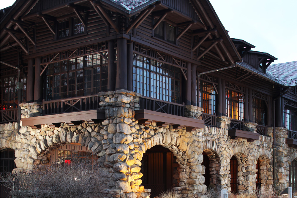
Finish your two-day hike at the Bear Mountain Inn: grab a beer and a plate at the Inn’s lunch spot, or just get an ice cream and sandwich at the sweet shop on the first floor before catching the bus back to the city. A round-trip ticket, from Port Authority to the start (and finish) of your hike, costs $24.60.
Remember to bring a water filter so you can gather water for your evening. In spring (when there’s ample run-off) the last water source before you get to the shelter is after you’ve come down off the Timp, but before you take the hillside that climbs to the shelter. I wouldn’t guarantee this as a water source in a hot, dry summer, though.
For carrying drinking water along the hike, I highly recommend Lifestraw’s Go Straw Bottle, which at the moment is selling for $20.00 at REI. It’s a water bottle that also filters your water as you drink it, so all you do is scoop it from the stream and drink, or carry it with you. My hiking partner picked one up before our John Muir Trail adventure last year, and I must admit I made fun of him for bringing the added weight. It soon proved me totally wrong. Hands down, my favorite equipment of the trail last year.
Also, remember to bring a map. I carry the indestructible Harriman-Bear Mountain trail map from the New York New Jersey Trail Conference (available online, from Amazon, or at REI, Campmor, or other outdoor retailers. Also available for sale at the Tuxedo Library (though it’s the old version). I also carry the map set on my phone, in the Avenza app. This is the way to go; you’ll be able to see exactly where you’re at along the trail. I bring an extra power stick or two to re-power my Iphone, but I also take care to use the “airplane mode” setting on my phone when I hike to cut down on power use.
 Verizon users, cell phone service at West Mountain shelter is strong, stromg enough to stream CNN during the primary debate the night I stayed there. Yes, I brought that to the peaceful heights of West Mountain (before I tuned out and opened Blue Highways.)
By the way, you can also download the Trail Conference’s free Bear Mountain Day Hikes map, which will give you some, but not all, of the trail mentioned here. As well, the trail map for Harriman State Park on New York State Parks’ website is a free, downloadable PDF — but it’s not as well-done as the Trail Conferences. For example, the state parks’ map shows a parking area in the middle of the Timp-Torne Trail on West Mountain!
Shortline Bus Schedule:
From Port Authority to Tomkins Cove (start of trail):
- Shortline 781 from Port Authority at 8:45 AM (daily). Arrives 10:11 am, OR
- Shortline 783 from Port Authority at 11:15 AM (daily). Arrives 12:41 pm.
To get home, catch the bus at the Bear Mountain Inn:
- Shortline 784 from Bear Mountain at 11:19 AM daily (back in NYC at 1:00 pm), OR
- Shortline 786 from Bear Mountain at 3:19 PM daily (back in NYC at 5:00 PM), OR
- On weekends and holidays, there’s an additional bus returning to New York: The Shortline 790 leaves Bear Mountain Inn at 5:19 PM, getting in to Port Authority at 7:00 PM.




Hi Suzy,
This sounds great, thank you! I am interested in the same monthly goal yet my only concern is being a solo woman overnighter hiker. I did one solo overnight last summer in Harriman and I loved it yet was a bit scared. Any words of encouragement?
Maybe carry some bear spray, helps me.
Good article!!!!!! Rss
Great piece. Excellent info. We should all spend more time outdoors under the stars.
Thanks!!!
Vinnie
Thanks so much for posting this info. I just completed this overnight hike and am currently sitting at the bear mountain inn restaurant drinking a much deserved beer.
Things I did differently:
Bus driver had no idea where the Tomkins Cove bus stop was and ended up dropping me off near Iona Island. I started hiking on the Cornell-Mine (blue) trail down to where it meets The Timp. Stayed at West Mountain shelter. In the morning I took the AT (white) to the Inn.
Really nice hike and the views along West Mountain were AMAZING. Since I was here mid-week I barely saw anyone on the trails.
Don’t you love the beer at the end? Thanks for leaving the comment! I don’t know why bus drivers can’t be a little more familiar with the route — it shouldn’t take much!
Glad you enjoyed the hike, and that the shelter was all yours (hope it was, anyway).
Thank you for sharing, I followed this last spring and then kept on visiting others shelters for the whole season. Your guides are very reliable and this thank you is long overdue.
I would like to add that the buses from NYC will stop at the parking lot in front of this trailhead without a problem.
Also there are buses to Sloatsburgh (only a 2 mile walk to the traihead) and at the AT crossing near Elk’s Pen. On the way back there aren’t that many buses at times so taking local buses to nearby train stations is also a possibility.
Thank you so much for maintaining this website; you’re really doing a great, great service to many people, myself included. The information you’ve put together isn’t available anywhere else (at least not in such a well organized and useable way). How can we support your efforts to maintain the website?
This hike sounds awesome. Looking forward to trying it this fall. Do you know how many miles it is from the trail head to the shelter?
Just saying thanks for being my favorite resource for Harriman! Going to do a two nighter at Stockbridge and West Mountain next week!
why is it always so difficult to find trail maps? Are they top secret?
I think I want to do this for my next overnight. Have you done this recently? This page (https://www.nynjtc.org/content/where-you-can-go-bus-or-train ) says that Tompkins Cove is closer to 1777 and that Jones Point is closer to Timp Torne.
Any advice? It seem hard to find out exactly where these bus stops are, but the town of Tomkins Cove does look to be about 2 miles south of the T-T trailhead.