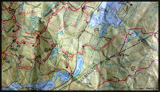
Map of Harriman State Park (northern section) including Lake Tiorati and Lake Askoti.
The forested slopes of Harriman State Park can contain gullies, trenches, rocky crags that you won’t be able to see through thickets of moutain laurel and blueberry. So, be careful. Never take shortcuts you don’t know or can’t see the length of (like a gully on a peak).
In Harriman, you can be tempted to take shortcuts, espcecailly after a long day of hiking where you just want to get back to the car. But ultimately these shortcuts can cost you in time and distance.
Besides, Harriman is the site of dozens of old, disused iron mines, many of which have become overgrown and hidden. Stumble into, say, Hogencamp mine, and who knows when they’ll see you again?
Just don’t.
The highly-entertaining and precise Trail Conference maps are available from Campmor or Eastern Mountain Sports, from the park store on the parkway (N 41° 17.323 W 074° 01.537), from the Sterling Forest Visitor Center, or by purchasing them online.

