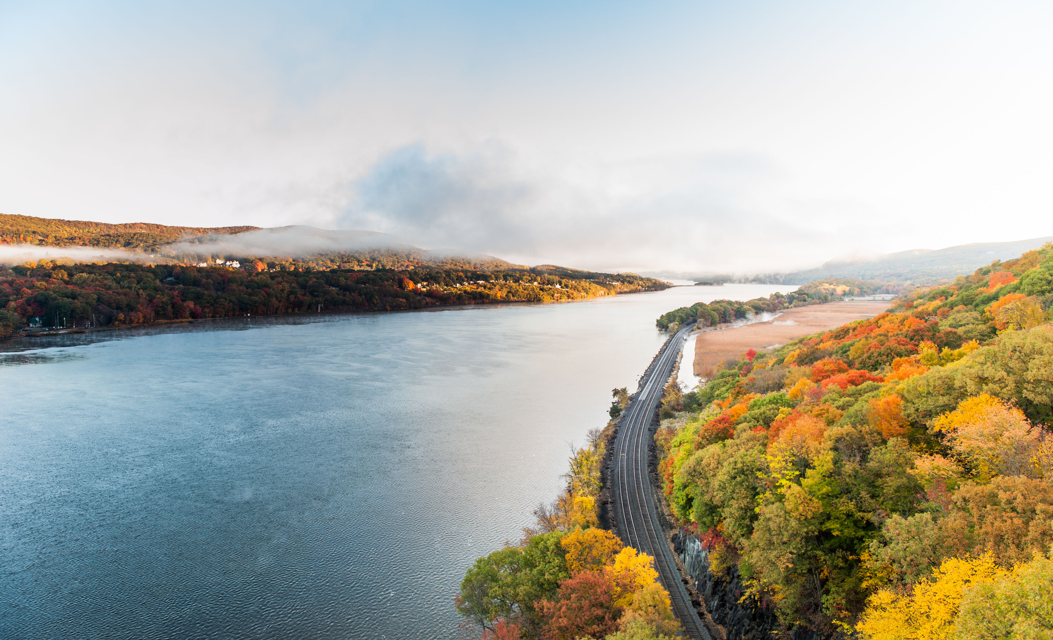
Sometimes mellow, sometimes strenuous, the Suffern-Bear Mountain Trail is one of the easiest to get to in Harriman State Park if you’re car-less or just want to leave the wheels at home. Take the Jersey Transit Main/Bergen line north to Suffern (towards Port Jervis), then it’s a short hop to the trailhead from the station. You can pick up basic provisions in the deli and grocery on the way, and for afterwards, there’s a barbecue joint right at the base of the trail. Superb.
Suffern’s Trail, Heading North.
I grew up in Upstate New York, where summers are signaled by Queen Anne’s Lace and cornflowers waving over old guardrails, and rivers flowing past darkly under old iron trestle bridges. The town of Suffern, New York, at the base of Harriman, reminds me that there is a dividing line between the “downstate” New York of Westchester and Rockland, and the wider, languid upstate that starts right around the bottom of Harriman. With its old timber train station, its little shops that are just a little bit dusty in the corners, with just enough in the way of amenities to send you on your way, the town of Suffern, New York, adds to the feeling of — kind of — going back in time.
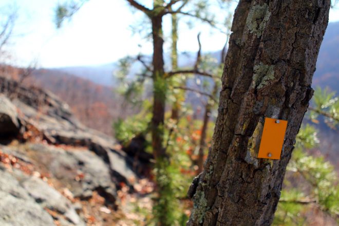
The Suffern-Bear Mountain Trail, a “stiff” trail that will challenge you to finish its 23-mile length, or simply climb to its many viewpoints and return to little Suffern, the upstate town at its base.
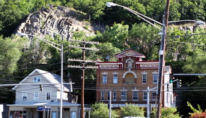
On a recent weekday afternoon, I was standing on the platform of the Jersey Transit train station in Suffern, NY. To my left, the face of Nordkop Mountain topped out over an old wooden telegraph pole that still bore its antique porcelain insulators.
I’m a huge fan of the Adventure Day: stepping off a train into the heart of a sleepy little town, picking up something from the local deli or diner and then hitting the trail. Suffern’s got the epic trail going for it — at around 23 miles, the S-BM is the park’s second-longest traverse — but it also has enough of the after-adventure amenities to fill you up afterwards. Add to that the ease of getting to the trailhead (once you know where it is), and you have a town with its own special delight, and the makings of a great weekend hiatus.
The Details:
- Train: Main/Bergen County Line
- Trail length: A 23-mile traverse which can be shortened to an out-and-back that’s as long as you can handle.
- Trail type: Medium to strenuous, with views, lean-to shelter.
- Very easy to get to trail from train station
- Recommended stops: The Bagel Train, Inc, for the non-sit-down breakfast; Deli & Grocery for chips, drinks, sandwiches; the Suffern Farmers Market (Saturday only) for breakfast, picnic fare and take-it-back-to-the-city local groceries; Fink’s BBQ and Cheesesteak Roadhouse for after-hike supper and local beers and ciders.
- Map Set: Use the New York New Jersey Trail Conference’s map 118 (and 119, if you’re hiking the entire trail). For your phone with GPS, use the app OpenMaps to navigate the trail as you hike, or download the Avenza map app and purchase the Trail Conference’s Harriman State Park maps within the Avenza app.
A Grocery, A Farmers Market, A Little Museum
To get to the trailhead from the train station, follow Chestnut Street under Orange Ave (towards town); then, almost immediately, turn a sharp left onto Blauvelt. It doubles back toward the tracks. Turn right onto Orange Ave; this is the road you’ll follow for .3 mile, to the trailhead. Easy! (There are yellow blazes painted at intervals on the sidewalk, but these are somewhat hard to pick up.)
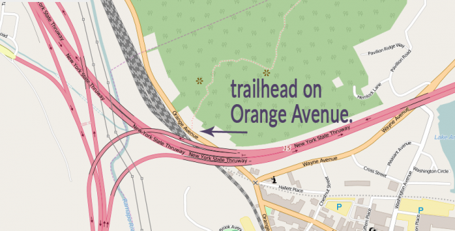
The trailhead for the Suffern-Bear Mountain trail, on Orange Ave in Suffern. It’s just past the I-87 overpass.
I stopped at the anonymous-looking “Deli & Grocery” on Orange Ave, and picked up some favorite items for my backpack: a couple of candy bars, electrolytes and a little sandwich. The deli is just a few steps along Orange Ave, toward the trail.
If you’re looking for breakfast: The town of Suffern has almost everything you’ll need to enjoy a full day or overnight, with the exception of breakfast. You are out of luck if you’re looking for a sit-down diner experience — something places like Suffern seem to have as a matter of course — but there’s still the Bagel Train Inc., just to the right of the train station and across the street. When I was there, I hit this place for a walking breakfast: an everything bagel with chicken salad and cranberries and almonds, and a morning jolt from their basic drip coffee. Delicious.
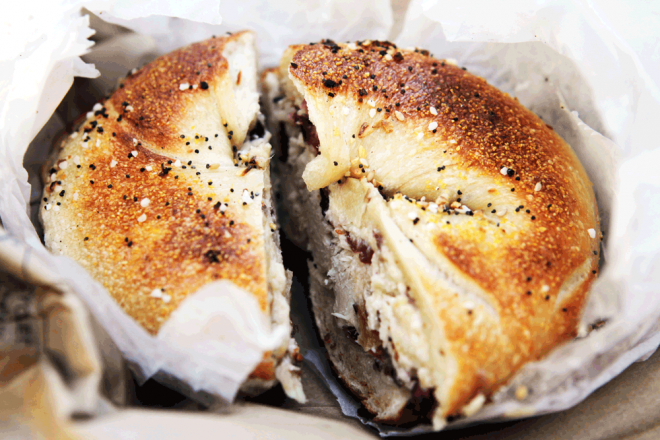
The everything bagel at Bagel Train Inc. Mine was stuffed with a chicken salad, almonds and cranberries.
You’ll pass a parking area on the left, and it’s worth ducking in here for two reasons. One, if you’re there on a summer Saturday before 1 pm, there a terrific Farmer’s Market that will supply not just your breakfast, but the fixings for a hikers’ picnic the way it’s meant to be: small, interesting samples of cheese, meat, and pastries, local to the Hudson Valley and the perfect dose of local delicacy. Two, there’s a tiny little train station, now a railway museum, at the furthest corner of the lot, under the overpass. It was closed when I visited, but looking through the window, I promised myself I’d come back for an hour or so to check out the displays of old railroad memorabilia.
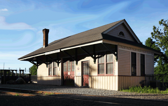
The Suffern Railroad Museum, in parking lot “A”, at the corner of Orange and Wayne Ave. It’s open to the public on Saturday, from 9am to 1pm, May to October, except holiday weekends (coinciding with the Farmers Market hours).
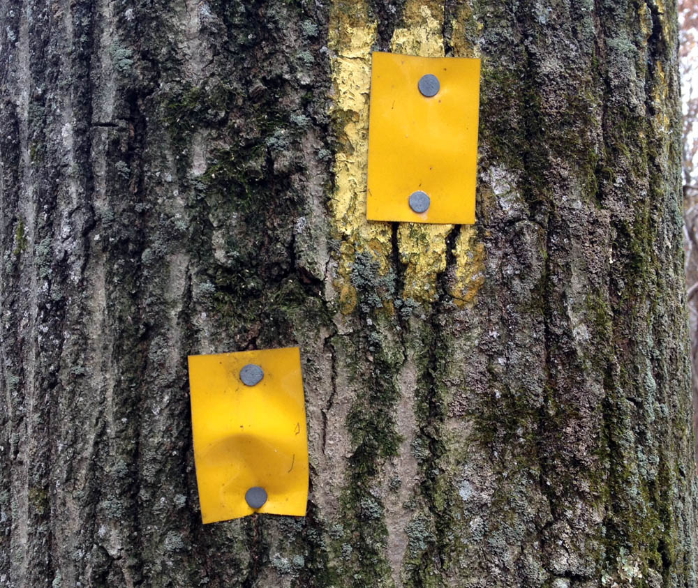
But, on to the trail. Continue under the overpass, and once to the other side, keep your eye out for yellow painted blazes on the right. At a crack between two boulders, you’ll spot the markers for the start of the trail as it hurries up the rocky hill.
This is the start of the Suffern-Bear Mountain trail. Like several other traversing trails, the S-BM is a town-to-town traverse, laid out at a time when there were not one, but two passenger train lines bordering the park. They made it possible for a hikers to travel by train to one side of the park, then cross the park entirely along a single path, where a train back to the city awaited them. Though the West Side Line no longer carries passengers, we still have those trails: The Tuxedo-Mount Ivy, the Suffern-Bear Mountain, the Ramapo-Dunderberg.
(One of the best descriptions of the Suffern-Bear Mountain was written by Raymond Torrey in his 1927 New York Times article on the occasion of the opening of the trail. You can read that article here: http://www.myharriman.com/suffern-bear-mountain-trail-83-years-ago-stiff-new-trail-calls-hikers/)
At the top of the hill, I stopped for a drink. The peak of Nordkop is perfect for lying back and taking in the converging train lines in the little town below, the , before continuing on the trail and channeling that lost-in-the woods feeling.
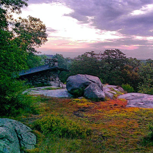
The appeal of the S-BM is its solitude. You’ll avoid the Visitor Center masses at Reeves Meadow along this trail, taking in some of the most rugged country in the park. You’ll skirt the crowds that flock to the Tom Jones shelter if you’re looking for something quieter at Stone Memorial shelter. If you do the out-and-back, just turn around when you’ve had enough. There’s a new place in town, right at the base of the trail.
The After-Adventure Hot Spot: Fink’s BBQ and Cheesesteak Roadhouse
Few foods are matched as perfectly to hiking a beer and barbecue. At Fink’s BBQ and Cheesesteak Roadhouse, the core of the menu is off-kilter barbecue and indigenous Hudson Valley beers and ciders. Mahogany chunks of smoked, then flash-fried (or “Friedaque”), chicken are served with sides like bourbon-soaked root vegetables and meaty baked beans. I ordered appetizers: the soft-shelled crab was hot and perfect, just spicy enough to go down well with a Doc’s Hard Cider. My friends got the beer cheese appetizer, an assortment of tart Granny Smith apples, pretzels and vegetables with a
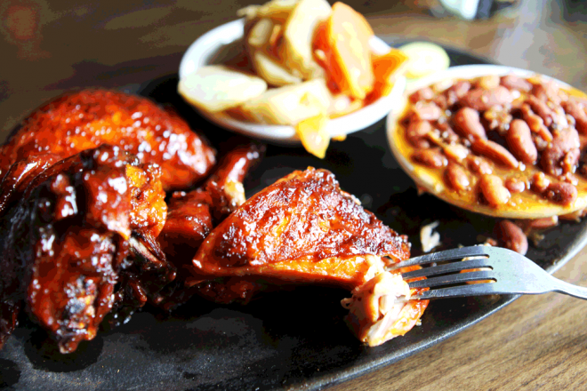
The smoked-then-fried chicken at Fink’s BBQ, right at the trailhead in Suffern. Mine was done just right.
My hope is that Fink’s will try something a little different and veer slightly away from the barbecue cliche of homespun truths on whitewashed boards, imported from somewhere near Memphis, and embrace the local. There is a growing culture of outdoor adventurers from the city who are looking for something authentic, and a barbecue joint at the bottom of a 23-mile, 90-year-old trail through the Ramapo Valley is as authentically Suffern as it gets. A few trail maps replacing the BBQ-themed chalkboards, a dish or two named after those storied trails and the mountains that embrace them — that would do wonders for the place Suffern is aspiring to be, and quickly closing in on.

